Overview
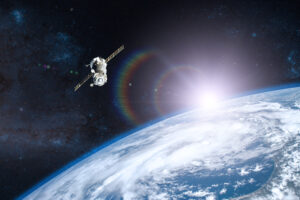
Lunasonde is a space-technology pioneer using satellite very low frequency (VLF) radar arrays to penetrate the Earth’s crust and generate 3D subsurface maps of groundwater and mineral deposits without ground disruption.
The challenge
- The problem: Severe climate-induced droughts and aquifer depletion trigger intense local conflicts over scarce freshwater reserves, especially in arid and border regions.
- Who it affects: Pastoralist communities, agricultural workers, and vulnerable populations in drought-stricken and climate-vulnerable zones.
The solution and technology
- Core tech: VLF deep-radar satellite constellations combined with subsurface tomographic imaging software.
- How it works:
- Launches SmallSats equipped with low-frequency radar payloads capable of penetrating up to two kilometers underground.
- Scans arid land to identify hidden, untapped aquifers and deep underground water reservoirs.
- Provides non-invasive subsurface spatial data to international aid organizations to inform sustainable water sharing.
Impact and recognition
- Key metrics: Developed orbital radar capabilities that map underground resource deposits, eliminating expensive and risky physical exploration in volatile zones.
- Recognition:
- Awarded the 2024 Kluz Prize Special Distinction for Space Technology for Peace.
- Founder and CEO Jeremiah Pate was named a Payload Pioneer (2024) by Payload Space, highlighting innovators leading early-stage orbital and deep-space infrastructure ventures.
Recent developments
- Constellation payload testing: Advanced orbital flight trials for high-resolution subsurface radar payloads.
- Humanitarian aquifer mapping: Partnered with regional development organizations to target water exploration in conflict-prone arid zones.
Why it matters
By pinpointing hidden water reserves from orbit, Lunasonde helps resolve zero-sum resource scarcity, preventing water wars before they begin.
Resources and citations
- Official website: Lunasonde
- Award announcements: